T: 01822 851370 E: [email protected]
RSN Voices Serious Concerns Over ‘Fairness’ Of Settlement
Read here...
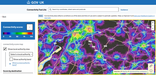
New DfT Connectivity Tool Now Live

The Department for Transport has launched a new Connectivity Tool, designed to help policymakers, planners, researchers and communities better understand how well different places are connected by transport.
The tool brings together transport and land-use data in an innovative way to generate a ‘connectivity score’ for every location across England and Wales, mapped at a highly detailed resolution of 100 metre by 100 metre squares. This fine-grained approach allows users to explore local variations in connectivity that are often missed in higher-level datasets.
Importantly, the Connectivity Tool is being made freely available online to everyone, supporting more informed decision-making around transport planning, local growth, service access and spatial strategies. It has clear potential value for rural areas, where connectivity challenges can vary significantly even within small geographies.
The Department for Transport hopes the tool will help inform:
- Local and national transport plans
- Spatial and land-use strategies
- Evidence bases for funding bids and policy development
Find out more and access the tool: https://www.gov.uk/guidance/connectivity-tool
 |
If you’re working on rural transport, access to services, or place-based policy, this is a new resource well worth exploring.


