10 Jul 2014
|
Working for our part of Rural England with the Rural Services Network |
|
|
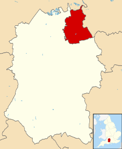
Location: South West Population: 217,160 (Mid-year estimate 2015) Interesting fact: Swindon Hill, 500 feet above sea level, attracted settlement from earliest times for its strategic position and excellent water supply. It is a great rock of Portland limestone that lies on top of the chalk hills and clay valleys of North Wiltshire. The Romans discovered it, quarried the stone and shipped it down to their settlement below the hill at Durocornovium on the main road between Silchester and Cirencester. The recent discovery of a complex of sanctuaries and temples at Abbey Meads near Blunsdon indicates both considerable settlement and religious significance.
|
||||
| Swindon |
Swindon is a member of the Rural Services Network and falls |
||||
Swindon Information |
||
| Phone number 01793 463000 |
Website www.swindon.gov.uk |
Local Enterprise Partnerships (LEPs) Swindon and Wiltshire |
| Frequency of elections Elections are by thirds |
Number of councillors 57 |
Political composition Conservative – 30 Labour – 25 Liberal Democrats – 2 |
| MPs North Swindon – Justin Tomlinson (Conservative) South Swindon – Robert Buckland (Conservative) |
Decision making structure Leader and a Cabinet |
Population change Population change One Year Population Change + 0.6% Ten Year Population Change + 14.5% |
| Police Authority Wiltshire Police Authority |
Fire Service Wiltshire Fire & Rescue Service |
Health Authority NHS South West |
| Area 23,009 Hectares |
Rural Output Areas 80 rural OAs from 713 OAs in total |
Audited by Southern Region (Audit Commission) |
| Rural Classification (Defra) Urban with City and Town |
Population by Area- (Density) 9.44 people per hectare |
Number of Parishes 16 |
| Number of Parish Meetings 0 |
Number of Parish Councils 14 |
Number of Town Councils 1 |
| Average house price £182,500 (Median price paid by local authority, year ending Q4-2015 – provided by UK HPI data published by Land Registry © Crown copyright 2016) |
Outsourced Services Information yet to be supplied |
Average age of population 38.1 (2011 Census data) |
| Main Towns Highworth, Swindon |
Unemployment rate 0.8% (JSA claimants for August 2017) |
Current Council Tax (amount reported is the amount received by the Council – no other services are included) 2014/2015 Council Tax – £1,146.09 2015/2016 Council Tax – £1,146.09 2016/2017 Council Tax – £1,168.90 2017/2018 Council Tax – £1,251.29 |
| Percentage of households socially rented from council or local authority 11.6% (2011 Census data) |
Percentage of population who have reported they are in very good health 48.3% (2011 Census data) |
Percentage of population which provides unpaid care 9.3% (2011 Census data) |
| Employment by Occupation Percentage of people aged 16 and over who are in Social Major Group 1-3 41.0% (ONS annual population survey – April 15-March 16) |
Average annual wage for full time employees
|
Percentage of those employed in full time employment 46.7% (2011 Census data) |
| Cars or vans owned per household (2011 Census data) No cars or vans – 21.6% 1 car or van – 44.2% 2 cars or vans – 27.3% 3 cars or vans – 5.3% 4 or more cars and vans – 1.6% |
Local Newspapers Information yet to be supplied |
National Park/AONBs North Wessex Downs (AONBS) |
2015 English Indices of Deprivation analysis tool
|
||

(All factual information on these pages is updated annually by the RSN)
(Information given via links will however be updated as new information becomes available)